

Qakh Tour
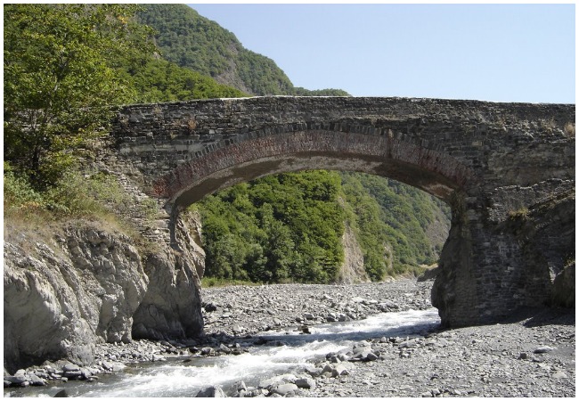
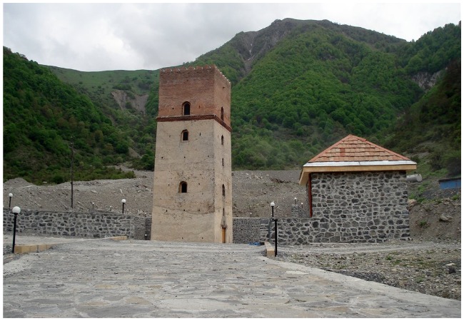
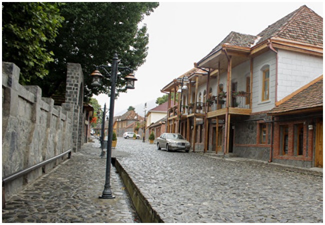
Are you planning to visit unique beautiful nature and get acquainted with the unique ancient history & culture of Azerbaijan?, then go to Qakh. We can arrange your trip to Gakh for your desires and choices. So, visitors will see several historical, cultural and architectural mocuments. As well as, fortress ruins, towers and a watchtower in this region. Albanian templates are one of the popular sites in Gakh.
Qakh Tour
So, you have the chance to see the first churches in the Caucasus and the first templates in the world. If you want to enjoy from nature bath called as Ilisu bath, then Qakh suits your desire. This ancient bath is located in Ilisu village. The construction period goes to the era of Ilisu sultanate. The thermal, sulfuric hot water, which comes out of the bathroom, has a great therapeutic significance. The bath is divided into two parts: ‘Boy Spring – Daughter Spring ‘ and the other part. This area has a huge tourism potential.
Territory and boundaries:
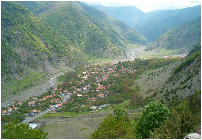
So, it is located in the north-west of the Republic of Azerbaijan. Established in 1930 as an administrative district. In 1963, it was abolished and its territory was transferred to Zakatala District, and in 1964 it became an independent district. The area is 1494 km2. It borders the Republic of Dagestan in the north-east, the Republic of Georgia in the south-west, Zagatala in the north-west and Sheki administrative districts in the southeast.
The northern and northeastern parts of the district include the southern slope of the main Caucasus ridge, the central part is the Kanikh-e-Golan valley, and the southern part is the Acinohur Front. The height of the area reaches approximately 100 m on the banks of the Acinohur Lake in the south and 3480 m along the main Caucasus range in the north. The mountainous part of the main slope of the Caucasus ranges has steep and sloping terrain. Marine sediments of the Jurassic and Cretaceous periods are common in this mountainous area.
Relief:
The southern and central parts of the area are mainly plains relief and are composed of neogenic and continental deserts, sand, sands, clay and clumps of Neogene and Quaternary periods.
CLIMATE:
The climate of the region is dry subtropical in the south, moderately warm in the central part, subtropical with moderate humidity and high in the highlands. Average temperatures in January are flat above 2 degrees Celsius, in the mountainous areas – up to minus 10 degrees Celsius, in July 26 and 50 degrees above zero. So, annual rainfall is 300mm in the south and 1600mm in the north. In the south of the district, there is a dry, moderately warm and subtropical climate, with cold in the mountains, and climatic conditions characterized by regular rainfall distribution. As we have seen, there are four climate zones in a relatively small area. Temperature variations in Gakh are very high, with temperatures ranging from minus 40 degrees to positive 40 degrees near ACINOHUR Lake. One of the characteristics of the region’s climate is its subtropics in many areas.
GROUND COVER:
So, the soil cover of the district is very diverse. There are grassy meadows, brown hills, alluvial meadows, forests, alluvial meadow, chestnut and carbon black sleeping areas. Alpine and subalpine meadows and forests (oak, peat, beetle, walnut, chestnut, etc.) occupy a wide area in the mountainous area. So, the area of
ANIMAL WORLD:
The fauna of the area is very rich. Among the animals living in the area are the Vashag, the Cat, the Snow Maiden, the Big Bird of the Birds, the Berkut, the Toglugger, the Caucasus, the Caucasus, the Caucasus, the Beige. In addition, wild animals such as bears, wolves, jackals, foxes, mammals and reeds, deer, jackal, Dagestan, wild boar, wild boar, etc. spread.
DRINKING SOURCES:
In the village of Ilisu Beşbulaq, Sangerbulag, Hamambulag, Gashrug spring in the village of Qashchay, Gotur spring in Lakit-Kotuklu village and others.
Mineral waters:
The Gakh region is rich in resort resources. Thermal springs near the villages of Ilisu and Saribash and along the Bath River is in folk medicine since ancient times. So, the presence of abundant mineral water resources has the potential to create climatic and balneological resorts in the region. Mineral water in the territory of Susken village. “Boy spring, girl fountain” in Ilisu village, Bath area. Treatment center – “Shafa” Recreation and Treatment House.
RIVERS:
There are 8 large rivers in the region. Ganikh river, which borders the Republic of Georgia, receives its source from Turkey and is 61 km from the district. Moving through the distance, Mingeçevir flows into the reservoir. The rest of the rivers come from the Great Caucasus Mountains. The length of the river Kurmuk is 54 km, the length of the river is 11 km. Ganik river, 8 km length of Lakit river. Gap river, 11 km length of Zarnaya river. Gary river and its source is located 58 km from the area of
Mountains:
The highest peaks of the district are Murana, Partizan, Kabirlyshash, Yarpizbasan, Kijali.
Waterfalls:
So, Ramramai waterfall is 25 meters in Ilisu village. Waterfall, which is distinguished by its uniqueness in Lakit village. The waterfall has been registered and protected by the Cabinet of Ministers of the Republic of Azerbaijan since 2006 as a natural monument.
